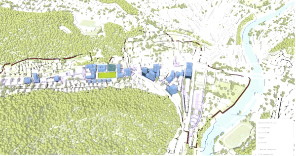
GIS-Analysis
Our GIS analyses reveal complex spatial relationships, thereby supporting informed decision-making—whether in urban development, climate adaptation, or crisis management. In a reference project, we were able to demonstrate how informed participation and GIS-supported resilience strategies work together by linking data, spatial reference, and participation: Expertise meets local knowledge – and this creates a solid foundation for sustainable decisions.
Process

Challenge
Every customer faces unique challenges—whether it's dealing with climate risks, adapting to demographic changes, or strengthening resilience. This starting point forms the basis for our joint approach.
Analysis
We use GIS-based analyses to collect and visualize relevant data. This makes risks, potential, and correlations transparent and allows them to be evaluated on a sound technical basis.

Meetings with steering group
The results are reflected upon, discussed, and refined in the steering group.

Implementation
The agreed measures are implemented in a practical manner. We accompany the process from planning to implementation and ensure that the results have a lasting effect and contribute to strengthening resilience.